RESEARCH/REVIEW ARTICLE
Hydrological response of a High-Arctic catchment to changing climate over the past 35 years: a case study of Bayelva watershed, Svalbard
Aga Nowak1
& Andy Hodson1,2
1 Department of Geography, University of Sheffield, Winter Street, Sheffield S10 2TN, UK
2 Arctic Geology, University Centre in Svalbard, P.O. Box 156, NO-9171 Longyearbyen, Svalbard, Norway
Abstract
Our study considers climate change and its influence upon the hydrology and water balance of the glacierized Bayelva watershed in Svalbard. We find that changes are most noticeable within the last 10 years, when winters have become warmer and wetter. The change is most significant during the shoulder months, especially September, when the transition from summer ablation to winter accumulation is taking place. Winter rainfalls, when extreme, produce ground icings and runoff outside the summer period. Dependent upon summer air temperatures, these icings may either melt and produce additional runoff or persist until the following hydrological year. These processes have a direct influence upon the water budget. They represent sources of error for water-balance calculations that either ignore winter runoff events and/or assume water storage is negligible. We show that even when the watershed is underlain by permafrost and accommodates cold-based glaciers, storage can no longer be ignored. Furthermore, we find that the use of a precipitation gradient correction of 19% per 100 m, a gauge catch correction and glacier mass-balance data (for snow accumulation and icemelt runoff) should be used for accurate water-balance calculations. We also find that despite sustained glacier retreat, annual runoff volume showed no trend during 1989–2010. Discharge is more variable and longer during the last decade due to the winter rainfalls. Finally, flow recession analyses reveal increasingly efficient evacuation of meltwater from the catchment and the increasing occurrence of a delayed flowpath through the glaciers’ forefield.
Keywords
Arctic hydrology; water balance; rain on snow; extreme events; Svalbard; climate change.
Correspondence
Aga Nowak, Department of Geography, University of Sheffield, Winter Street, Sheffield S10 2TN, UK. E-mail: aga.nowak.09@gmail.com
(Published: 1 August 2013)
Polar Research 2013. © 2013 A. Nowak & A. Hodson. This is an open-access article distributed under the terms of the Creative Commons Attribution-Noncommercial 3.0 Unported License (http://creativecommons.org/licenses/by-nc/3.0/), permitting all non-commercial use, distribution, and reproduction in any medium, provided the original work is properly cited.
Citation: Polar Research 2013, 32, 19691, http://dx.doi.org/10.3402/polar.v32i0.19691
It is widely acknowledged that the climate has been warming and the High Arctic is particularly vulnerable to changes in air temperature and moisture (Symon et al. 2005; Anisimov et al. 2007). The scientific community is beginning to realize that the hydrological response of glaciarized catchments to this climate change is far more complex than it was originally believed, especially, when the relationships between air temperature, precipitation and glacial mass balance are considered. Increasing air temperature and precipitation have already been affecting the High-Arctic environment of Svalbard (Hanssen-Bauer 2002) and it is now known that winter months have been influenced the most (Beldring 2009; Førland et al. 2009). Downscaled and regional climate models for the High Arctic predict further increases in annual air temperature by 2–8°C and in precipitation by up to 40% (Benestad 2008; Førland et al. 2009). Such changes will have various consequences for our understanding of the water budget and hydrological processes in the High Arctic. They can: (1) prolong the melt season (Sharp and Wolken 2010), (2) deepen the active layer (Åkerman 2005), and (3) warm the permafrost (Boike 2009; Christiansen et al. 2010). They can also cause: (4) rain on snow, thaw—refreeze events, slush avalanches (Eckerstorfer & Christiansen 2012), and (5) the formation of ground icings. In a hydrological year (1 October–30 September), (1)–(3) may act as a water source by producing more meltwater from glacial ice and ground ice. Additionally, (2) and (5) may act as a water store and therefore prolong the transfer of meltwaters over a range of time scales. Furthermore, (4) may influence glacier mass balance by redistributing snow across the landscape and also by changing the type of accumulation that is occurring (i.e., the creation of superimposed ice layers vs. firn densification). Measurement of these local changes in the quantity, distribution and form of precipitation can provide real challenges for glacier mass-balance monitoring (e.g., Jansson 1999; Østrem & Haakensen 1999; Zemp et al. 2009).
Predicting the hydrological response of Svalbard's glaciarized catchments to the above climate change scenario is therefore complicated and depends on many variables. Additionally, collecting and processing precipitation data is very demanding and not without errors associated with catch efficiency and the altitude gradient (see Killingtveit et al. 2003). Furthermore, existing water budget studies (such as Hodgkins et al. 2009; Cooper et al. 2011; Rutter et al. 2011) are based on short-term (one or two ablation seasons) observations, and although they describe hydrological processes in detail, they do not enable predictions of the long-term hydrological response of High-Arctic catchments to climate change to be made.
Therefore, here we present an updated water-balance study based on meteorological, hydrological and mass-balance monitoring for, respectively, 35, 22 and 43 years in the important Bayelva watershed that lies in the immediate vicinity of the international research facility at Ny-Ålesund in the Norwegian High Arctic. The research represents part of a wider study of biogeochemical response of a High-Arctic catchment to climate change, and places particular emphasis upon temperature and precipitation change during the winter and so-called shoulder seasons (spring and fall). Mass-balance records of glaciers within the catchment are examined and incorporated into water-balance calculations. Furthermore, various models for predicting river annual discharge are considered after establishing their sensitivity to the various precipitation correction procedures that are in the literature. Finally, the investigation includes traditional hydrological and statistical analyses of hourly and daily runoff data to complement the annual water balance analysis by trying to reveal the response of this cold-based glacial basin to changing climate.
Location
The Bayelva catchment is located on the Brøggerhalvøya peninsula in the western part of Oscar II Land (Fig. 1). The catchment has already been widely described in numerous publications (e.g., Repp 1988; Hagen & Lefauconnier 1995; Hodson, Gurnell, Tranter et al. 1998; Hodson, Gurnell, Washington et al. 1998; Hodson et al. 2002; Killingtveit 2004; Hodson et al. 2005). It covers 32 km2, ranges in elevation from 4 to 742 m a.s.l. and is surrounded by steep mountain ridges to the south and waters of Kongsfjorden to the north. The southern and eastern part of the watershed is underlain by red sandstones, quartzite and phyllite, while the northern and western by sedimentary rocks, such as sandstone, shale, dolomite and limestone (Orvin 1934; Hjelle 1993; Bruland & Hagen 2002; Hodson et al. 2002; Sund 2008). The area of the catchment is almost entirely underlain by permafrost with seasonal active layer measuring from 0.5 to 1.5 m (Repp 1988; Killingtveit 2004). The catchment is 50% glaciated by the cold-based valley glaciers Austre and Vestre Brøggerbreen (hereafter AB and VB), whose thicknesses are below 100 m (Bruland & Hagen 2002; Hodson et al. 2002; Sund 2008). Although the watershed accommodates these two valley glaciers, it is undeniably AB (78.897 N, 11.824 E) that has been studied the most. It extends from 50 to 600 m a.s.l. and according to Lidar surveys performed in 2005, it covers an area of approximately 9.4 km2 (Bruland & Hagen 2002; Porter et al. 2010). During the ablation season, meltwaters are routed through an extensive supra-glacial drainage network to cut-and-closure style englacial channels via a number of well-developed moulins. Meltwaters then discharge onto a sandur plain and are eventually conveyed through a well-defined rock channel into Kongsfjorden. No meltwater storage as proglacial icings (as in Hodgkins et al. 2004) occur in the catchment. Average air temperature and precipitation in the watershed measured at 8 m a.s.l. over 41 years between 1969 and 2010 were −4.9°C and just below 400 mm a−1, respectively (precipitation values uncorrected for catch). An average temperature at AB's equilibrium line altitude (ELA) was −8°C (Hagen & Sætrang 1991; Hagen et al. 1993; Hisdal 1993; Hodson 1994; Bogen & Bønsnes 2003).

Fig. 1
The location of the study area on the peninsula Brøggerhalvøya, near Ny-Ålesund, Svalbard, with boundaries of Bayelva watershed and the location of hydrological (BAY) and meteorological (W) monitoring stations. BAY is located at 78.9335 N, 11.838 E, and weather station 99910 is at 78.923 N, 11.933 E. Maps modified from Norwegian Polar Institute's online map resource, www.toposvalbard.npolar.no.
Methods
Temperature and precipitation change within the watershed
Meteorological data in the Ny-Ålesund area have been collected since 1967 by the Norwegian Meteorological Institute and are available for free download from the eklima.met.no web portal. In this article, air temperature and precipitation data from weather station 99910 were used (Fig. 1). The station is located at 78.923N, 11.933E, at 8 m a.s.l and has operated since 1974. Mean air temperature (Ta) data that were filtered using a Gauss filter 3.0 with a gliding slope of 10 years were also downloaded to depict trends in climate change at this site. Precipitation types were deduced from air temperature and classified as snow or rain (when Ta<0°C or Ta>0°C, accordingly). Measured precipitation data were then corrected for catch (Pc) by the value of 1.15 (rain) and 1.65 (snow), after Killingtveit (2004). Finally, several different elevation gradients were applied that have been employed in the past (see Table 1). The different elevation gradients exist on account of uncertainty and variability in orographic effects upon precipitation and a full discussion is presented by Killingtveit (2004).
Table 1 Precipitation gradients used in the literature for calculating true precipitation in the Norwegian High Arctic. Corrections producing optimum results (marked with asterisks) were selected for the final discharge models.
| Type of precipitation |
Elevation correction per 100 m (%) |
Reference |
|
15* |
Killingtveit (2004)
|
|
19* |
|
|
20 up to 300 m |
Førland et al. (1997)
|
| Rain and snow |
25* |
Hagen & Lefauconnier (1995) |
|
16 |
Sand et al. (2003)
|
|
12 |
Mercier (2001)
|
| Rain |
15* |
Killingtveit (2004)
|
| Snow |
25* |
Hodson et al. (2005)
|
| Snow |
14 |
Tveit & Killingtveit (1994)
|
Austre Brøggerbreen's mass-balance change
The Norwegian Polar Research Institute has conducted the mass-balance measurements of AB since 1966. Stake measurements, snow depth and density observations and the collection of shallow superimposed ice-cores are conducted in May and September–October at the end of accumulation and ablation periods, respectively. All mass balance data used in this article have been acquired from Jack Kohler (pers. comm. 2011). Further details are available in Kohler et al. (2002) and Kohler (2010).
Bayelva runoff
Hydrological monitoring of Bayelva has been carried out continuously since 1989 by the Norwegian Water Resources and Energy Administration (NVE). The position of the gauging station (Fig. 1) allows for the determination of runoff from the whole Brøggerbreen catchment area. Early discharge records for the period 1975–78 were acquired from Hagen & Lefauconnier (1995). Errors associated with the discharge rating curves used to calibrate the records are thought to be 5% or less, according to Skretteberg (1991).
Water balance for the Bayelva catchment
Surface water runoff from the catchment was calculated from the water-balance equation (Eqn. 1) modified from Hagen & Lefauconnier (1995) and Killingtveit et al. (2003).

where Pa is the areal precipitation with both catch and elevation gradient corrections applied (mm a−1); Bs is the summer mass balance of the glaciers (mm a−1); C is condensation (mm a−1); Qs and Qg are, respectively, surface and groundwater runoff from the watershed (mm a−1); Ea is evaporation (mm a−1); ΔS is change in catchment's water storage (mm a−1); and ϵ is residual balance (mm a−1).
Various models for predicting surface water runoff (hereafter Qs) in the Bayelva watershed were explored under the assumption that ϵ=0. The predicted discharge (hereafter Qp) was derived from estimates of ice-, firn- and snowmelt, winter and summer precipitation, evaporation and condensation. In keeping with the earlier studies conducted here (i.e., Hagen & Lefauconnier 1995; Killingtveit et al. 2003), the storage term was assumed to be negligible in the first instance: an assumption based on the glaciers’ cold-based thermal regime, the presence of permafrost in the watershed and, as suggested by Killingtveit et al. (2003), the long time period of analyses. Ice-, firn- and glacial snowmelt in the watershed were calculated from summer mass balance of AB extrapolated over both glaciers in the catchment (50% of the total area) on account of their near-identical hypsometry. Winter precipitation on non-glacierized areas below 100-m elevation was calculated from winter Pc at the monitoring station (summed for all intervals when discharge was not recorded). Winter precipitation on mountainsides (i.e., above 100-m elevation) was estimated as 26% of winter mass balance on the glacier surface, based on the areal extent of this terrain in the catchment. It was then assumed that all precipitation, which fell as snow outside the glacier, melted during the summer. Summer Pc was corrected for elevation according to different gradients presented in Table 1. In so doing, we maintained the use of 50-m elevation zones that has been traditionally used with respect to the glacier mass-balance monitoring (Kohler et al. 2002; Kohler 2010) and geochemical flux studies (Hodson et al. 2005) conducted in this basin over the last 35 years. Additionally, three different summer periods were considered: (1) June, July, August (hereafter JJA) employed by Hagen & Lefauconnier (1995); (2) June, July, August, September (hereafter JJAS); and (3) JJAS + P_Q which included all precipitation events that occurred when discharge of Bayelva was observed. Precipitation causing discharge that occurred during months other than JJAS was assigned to the appropriate hydrological year. Precipitation in JJA in 2000 was not included in the analyses due to the lack of daily precipitation records in the Eklima data. Finally, evaporation and condensation were assumed to be constant after Hagen & Lefauconnier (1995) at 46.88 and 9.38 mm a−1, respectively, as derived from the sparse measurements in the area (Killingtveit et al. 2003).
The full range of water-balance models employed to estimate Qp is described in Table 2. Error analyses were performed to indicate the best model for reconstructing Qs. Therefore, the mean error (ME) was calculated to examine whether the Qp models over- or under-estimated measured discharge and the root mean-square error (RMSE) used to indicate the standardized mean error of each model. The Nash–Sutcliffe efficiency criterion (E) and coefficient of determination (R2) were then used to indicate which model fitted best (E and R2 ∼ 1) to the measured discharge data series (Krause et al. 2005). Finally, two years: 1999 and 2008, were excluded from data series. These years represented very significant outliers for which the quality of one or more of the water-balance terms (defined above) was questionable.
Table 2 Models for estimating predicted runoff (Qp) of Bayelva, where P_JJA is areal precipitation during June–August (mm); P_JJAS is areal precipitation during June–September (mm); P_Q is daily winter precipitation causing discharge (mm); Pwinter(ngs) is areal winter snowfall on non-glacierized areas(mm); Bs is summer mass balance (mm a−1); Ea is evaporation (mm a−1); and C is condensation (mm a−1). The best model for calculating Qp resulting in smallest errors and the best fit to the measured discharge is presented in boldface. Models 1.0–1.2 were based on Hagen & Lefauconnier (1995).
| Model no. |
Models for estimating predicted runoff (Qp) |
Precipitation gradient correction |
R2a
|
MEb
|
RMSEc
|
Ed
|
| 1.0 |
16.253*Bs+0.057*P_JJA + 5.498 |
25% rain and snow |
0.37 |
96.9 |
163.3 |
0.16 |
| 1.1 |
16.253*Bs+0.057*(P_JJA + P_Q) + 5.498 |
25% rain and snow |
0.60 |
21.8 |
122.3 |
0.62 |
| 1.2 |
16.253*Bs+0.057*(P_JJAS + P_Q) + 5.498 |
25% rain and snow |
0.66 |
−101.0 |
144.4 |
0.62 |
| 2.0 |
Pwinter(ngs) + P_JJA + Bs+C−Ea
|
15% rain and snow |
0.27 |
221.5 |
249.2 |
−0.06 |
| 2.1 |
Pwinter(ngs) + P_JJAS + Bs+C−Ea
|
15% rain and snow |
0.41 |
126.5 |
175.1 |
0.11 |
| 2.2 |
Pwinter(ngs)+(P_JJAS + P_Q) + Bs+C−Ea
|
15% rain and snow |
0.65 |
68.6 |
121.8 |
0.56 |
| 3.0 |
Pwinter(ngs) + P_JJA + Bs+C−Ea
|
25% rain and snow |
0.28 |
213.0 |
242.7 |
−0.05 |
| 3.1 |
Pwinter(ngs) + P_JJAS + Bs+C−Ea
|
25% rain and snow |
0.43 |
112.9 |
166.9 |
0.15 |
| 3.2 |
Pwinter(ngs)+(P_JJAS + P_Q) + Bs+C−Ea
|
25% rain and snow |
0.66 |
51.7 |
115.1 |
0.61 |
| 4.0 |
Pwinter(ngs) + P_JJA + Bs+C−Ea
|
19% rain and snow |
0.29 |
208.1 |
239.0 |
−0.04 |
| 4.1 |
Pwinter(ngs) + P_JJAS + Bs+C−Ea
|
19% rain and snow |
0.43 |
105.0 |
162.4 |
0.17 |
| 4.2 |
Pwinter(ngs)+(P_JJAS + P_Q) + Bs
+C−Ea
|
19% rain and snow
|
0.66
|
42.0
|
112.2
|
0.63
|
| 5.0 |
Pwinter(ngs) + P_JJA + Bs+C−Ea
|
15% rain and 25% snow |
0.28 |
213.1 |
242.7 |
−0.05 |
| 5.1 |
Pwinter(ngs) + P_JJAS + Bs+C−Ea
|
15% rain and 25% snow |
0.38 |
103.5 |
165.6 |
0.12 |
| 5.2 |
Pwinter(ngs)+(P_JJAS + P_Q) + Bs+C−Ea
|
15% rain and 25% snow |
0.62 |
42.5 |
117.8 |
0.59 |
| aCoefficient of determination. |
| bMean error (mm a−1). |
| cRoot mean-square error (mm a−1). |
| dNash–Sutcliffe efficiency criterion. |
Optimum estimates of Qp were then used to fill gaps in the Qs time series to create a complete water balance in the Bayelva watershed for the hydrological years 1974/75–2009/10.
Hydrological analyses
Hourly and daily discharge data sets acquired from NVE were used to perform various analyses for the 22 years of flow records. Therefore, flow duration curves (FDC) were used to study the variability of Bayelva's flow regime and flow recession analysis was undertaken to uncover seasonal changes in the catchment's flow routing characteristics. Various FDCs were created from mean daily discharge using Oregon State University's streamflow analysis techniques (http://streamflow.engr.oregonstate.edu/analysis/flow/index.htm) for: (1) the whole period of record (1989–2010); (2) 1989–1999, 2000–10; and (3) individual years of Bayelva flow.
Flow recession analyses were also performed according to Gurnell (1993) for three selected years—1991, 2000 and 2009—representing the beginning, middle and the end of the data records. Furthermore, the years were also chosen on the basis of their similarity. Therefore, they were not subjected to extreme rainfall events, unusually high or low discharge duration, magnitude and mean air temperatures. For each year, linear segments of individual diurnal recession curves were identified visually from breaks in the slope of semi-logarithmic plots of discharge against time (Gurnell 1993; Sujono et al. 2004; Rutter et al. 2011). Storage constants (K) for each recession segment were then estimated using the following equation:
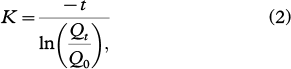
where t is the time (hours) since the start of the recession segment of the hydrograph; Q0 is the reservoir's initial discharge (m3 s−1); and Qt
is discharge at time t (m3 s−1).
After log-transformation of the discharge data, the K values were calculated using linear regression best-fit lines applied to each recession segment, thus allowing for some compensation for errors in Qs. Each diurnal hydrograph was examined independently. Days that either failed to exhibit a clear, diurnal melt discharge signal (i.e., the significance level of the slope of the regression models was <95%), or days when precipitation influenced the discharge recession were excluded from the analysis. Storage constants for up to three consecutive reservoirs (K1, K2, K3) were identified in the data set.
Results
Temperature and precipitation change within the watershed
Mean Ta and Pc data for the hydrological year of the Bayelva catchment show distinct decadal and seasonal increases within the last 30 years (Fig. 2). It is noticeable from the separate decadal seasonal series that mean Ta has been increasing during both winter and summer, with the highest rise within the last 10 years (winter: 1.7°C and summer: 0.4°C), while Pc has been increasing, only during winter. Spearman's rank correlation coefficients between Ta, rain and snow (corrected for gauge catch), showed significant positive correlation between winter Ta and rainfall and significant negative correlation between April, May, June and September Ta and snowfall (Table 3). Closer investigation of Ta changes during the winter months showed that mean Ta in the “shoulder months” (March, April, May and September, October) increased most significantly during April and May, with just a slight increase in September and October (Fig. 3). The examination of precipitation types during shoulder months indicated that although March, April and October were dominated by snowfall, rain events in those months were not uncommon during the last 35 years of records. In contrast, May and September were dominated by rainfall with a sporadic appearance of snowfall. It was noticeable that during eight of the last 10 years of records, rainfall has been the more dominant form of precipitation during May, September and October. For the remaining shoulder months, March and April, the dominance has not occurred although the incidence of rainfall in April has increased (Fig. 4).

Fig. 2
Average seasonal changes by decade in (a) air temperatures and (b) Pc measured precipitation corrected for catch errors, after Killingtveit et al. (2003). Winter is defined as 1 October until 31 May, while summer is 1 June until 30 September.

Fig. 3
Mean air temperature trends of shoulder months with their long-term averages recorded at the 99910 weather station. Data downloaded on 15 December 2011 from www.eklima.met.no.

Fig. 4
The percentage of snowfall and rainfall during precipitation events recorded throughout shoulder months. Precipitation was corrected for catch errors. Precipitation in May and September in 2000 was deleted due to lack of daily precipitation records in the Eklima data set.
Table 3 The results of the correlation between monthly mean air temperature (Ta) and precipitation in the Bayelva catchment.
|
Spearman's correlation |
| Months |
Ta vs. raina
|
Ta vs. snow |
| January |
0.666**b
|
−0.101 |
| February |
0.331*c
|
−0.026 |
| March |
0.523** |
0.111 |
| April |
0.530** |
−0.469** |
| May |
0.239 |
−0.456** |
| June |
−0.056 |
−0.385* |
| July |
−0.146 |
−0.162 |
| August |
0.023 |
−0.255 |
| September |
0.568** |
−0.505** |
| October |
0.577** |
−0.072 |
| November |
0.578** |
−0.022 |
| December |
0.516** |
−0.134 |
| aAir temperature (°C). |
| bCorrelation is significant at the 0.01 level (two-tailed). |
| cCorrelation is significant at the 0.05 level (two-tailed). |
Austre Brøggerbreen's mass-balance change
Despite yearly variations in the glaciers’ winter and summer mass balance (Fig. 5), AB has been almost constantly retreating between 1966 and 2010, with a total mass loss of 21.1 m water equivalent (Fig. 6). There have been just two years with small positive net mass-balance gains (1987 and 1991). Average winter, summer and net mass balances over the observation period were 0.66±0.15, −1.14±0.30 and −0.48±0.33 m a−1, respectively. Spearman's rank correlation performed on glaciers’ mass-balance and meteorological data revealed significant negative correlation of summer mass balance with Ta in July (ρ= −0.620, P=0.01) and events of temperature below 0°C in September (ρ= −0.683, P=0.01). Events of temperature below 0°C refers to every record of Ta below 0°C (in the thrice daily monitoring interval of 6:00, 12:00 and 18:00). Winter mass balance correlated well only with snowfall in May (ρ=0.562, P=0.01). Spectral analysis performed using SPSS Statistics software did not show any significant cycles in the winter, summer or net mass-balance series.

Fig. 5
Winter, summer and net mass-balance record of Austre Brøggerbreen glacier. Net balance is the sum of winter and summer mass balance (data from Kohler, pers. comm. 2011).

Fig. 6
Cumulative mass balance of Austre Brøggerbreen (data from Kohler, pers. comm. 2011).
Bayelva runoff
The number of days each year with observed discharge (Fig. 7) varied throughout the whole period of records from 61 to 155 days with neither any significant trend nor any correlation with summer mean Ta or Pc. The start of discharge was relatively constant and only showed a negative correlation with mean Ta in April and June (ρ= −0.426, P=0.05 and ρ= −0.431, P=0.05, respectively). The end of flow, although more variable than the beginning, also did not show any correlation with either summer Ta or summer Pc, but correlated well with rain in September and October (ρ=0.453, P=0.05; ρ=0.489, P=0.05). The magnitude of mean daily discharge depended more upon mean daily air temperature (ρ=0.559–0.838, P=0.01) than precipitation (ρ=0.072–0.574, P=0.01). Annual minimum Qs did not correlate with summer Ta nor Pc while annual maximum Qs correlated significantly with September rain (ρ=0.502, P=0.05). No statistically significant correlations between discharge and the North Atlantic Oscillation index were found (ρ= −0.006–0.295, P<0.05).

Fig. 7
Records of days with discharge of Bayelva in the Brøggerbreen catchment from 1989 until 2010: (a) commencement and cessation of runoff; (b) The duration of discharge (in days) with linear regression line showing no significant trend.
The majority of discharge occurred between 1 June and 30 August, with very variable discharge magnitude during September–October and only a sporadic appearance of flow during January–May and November–December (Fig. 8). During 1989–1999, the average duration of the flow was 108 days, which was nine days shorter than the second half of the observation record (2000–10). The difference in flow duration in those two periods was entirely the result of the occurrence of flow before 1 June and after 30 September (hereafter early and late flows). For example, early flows were recorded on six and 46 days during 1989–1999 and 2000–10, respectively, while late flows were recorded on 20 and 80 days accordingly. The sum of Qs for 1989–1999 and 2000–10 was 10.5 and 11.9 m, respectively. Mean Qs from 1989 until 2010 was 1.08±0.21 m a−1 with a minimum of 0.56 m a−1 (2010) and a maximum 1.42 m a−1 (2008).

Fig. 8
Monthly specific discharge of Bayelva. Data source: Norwegian Water Resources and Energy Administration.
Water balance for the Bayelva catchment
The results of the predicted runoff models, their fit to the observed time series and total errors are presented in Table 2. Model 4.2 was selected as the best predictor of measured discharge. It included summer Pc derived from JJAS, winter rain events causing river discharge and a 19% precipitation gradient (for rain and snow). The model underestimated Qs with an ME of 42.0 mm a−1 and had a Nash–Sutcliffe E value of 0.63.
The water-balance calculations performed for the years 1974/75–1977/78 and 1989/90–2009/10 for which Qs rather than Qp was used had a mean residual value (ϵ in Eqn. 1) of 44 mm a−1 (standard deviation 161 mm a−1). The water balance calculated for the period 1974/75–2009/10 with the use of predicted runoff, produced a mean ϵ of 31 mm a−1 (standard deviation of 138 mm a−1). The values of ϵ are presented in Fig. 9. Even though the mean and standard deviation of ϵ for the whole period of records were relatively small, there were some years with more extreme values in the range −250 to +386 mm a−1 (the positive values being indicative of storage). A variable, sometimes a significant source of error, was therefore present in the calculations that require a discussion below.

Fig. 9
The residual term in the water balance of Bayelva derived from measured and predicted runoff data.
Hydrological analyses
The FDC analyses performed for measured runoff (Fig. 10) showed that the 25th, 50th and 75th percentiles corresponding to high, median and low flows of the entire record were 5.11, 3.22, and 0.85 m3 s−1 accordingly. Values in years 1989–1999 and 2000–10 differed only slightly and were 5.13, 3.16, 1.00 m3 s−1 and 5.04, 3.26, 0.75 m3 s−1, respectively (Fig. 11). FDC analysis performed for every year of record revealed that flows during 2000–10 were much more variable than during 1989–1999. The variability of the flows is presented in Fig. 10b and c where the outstanding FDCs are compared to the FDC of the entire period of records. Higher flow years were mainly recorded during 1989–1999 while years with lower flow were mainly recorded during 2000–10.

Fig. 10
Flow duration curves for Bayelva showing: (a) two periods of records 1989–1999 and 2000–10; (b) outstanding years with steeper curves of low flows than the whole period of records; and c) outstanding years with shallower curves than the whole period of records.

Fig. 11
Flow duration values of Bayelva during 1989–1999 and 2000–10.
Flow recession analysis performed for three selected years representing the beginning, middle and the end of the period of measurement (1991, 2000 and 2009), showed significant changes of K1 and K2 reservoirs (Fig. 12, Table 4). It is therefore apparent that the K1 reservoir values decreased both over the entire period of record, and during each season. Furthermore, the seasonal decrease became more distinct at the end of the observational period than at the beginning. The appearance of the K2 reservoir became more frequent with time and its values, although more variable than K1, also decreased as the season progressed. The K3 reservoir was only recorded a few times during 2000–10 (Table 4) and therefore it was not possible to notice any trends.

Fig. 12
Flow recession analysis of Bayelva for 1991, 2000 and 2009: (a) K1 constant values (hours) represent fast water flowpaths; (b) K2 constant values (hours) represent delayed water flowpaths.
Table 4 The results of flow recession analyses of Bayelva for years representing the beginning, middle and the end of data records. K1–K3 represent different storage reservoirs.
| |
1991 |
2000 |
2009 |
|
Average (hours) |
| K1 |
29 |
25 |
16 |
| K2 |
95 |
64 |
32 |
| K3 |
0 |
14 |
25 |
|
Counts |
| K1 |
43 |
31 |
45 |
| K2 |
7 |
11 |
24 |
| K3 |
0 |
2 |
2 |
|
Minimum (hours) |
| K1 |
14 |
9 |
1 |
| K2 |
47 |
7 |
3 |
| K3 |
0 |
12 |
14 |
|
Maximum (hours) |
| K1 |
57 |
47 |
43 |
| K2 |
160 |
174 |
192 |
| K3 |
0 |
16 |
36 |
Discussion
Temperature and precipitation change and their influence on catchment's hydrology
The results of statistical analysis of Ta and Pc performed for the period 1975–2010 indicate that the biggest changes in the catchment's climate were recorded during the winter, as indicated by Førland et al. (2009) and Beldring (2009). Furthermore, those changes are more intense during the last 10 years. The increase in winter air temperatures had a direct connection to the increase in winter rainfall. Rainfall during shoulder months, although not unusual, also became more frequent within the last 10 years. It is significant that although April and May were the two months most affected by the increase in air temperature, and September was affected the least, it is the change during the latter that had the biggest influence on hydrology of the catchment. The reason is that September's mean air temperature lies close to 0°C and so the changes influence precipitation type (from snow to rain). Air temperature changes in September also had a direct effect upon the timing of the transition from ablation to accumulation and therefore influenced the mass balance of the glaciers existing within the catchment. The beginning of the ablation season was also influenced by temperature changes in April and June. Therefore, a near-constant, steady retreat of at least one glacier existing within the catchment has been documented (Kohler 2010).
Changes in air temperature and precipitation were also reflected in the Bayelva runoff. During summer months, melt-driven river flow depended more on air temperatures than precipitation. However, during winter, rainfall events were directly responsible for the early and late flows of the river. Changes in the discharge before 1 June and after 30 September distinguished years 1989–1999 and 2000–10. Of particular importance is the fact that flows that occurred outside the main summer months were more apparent during 2000–10 (3.8% of total discharge in that period as opposed to 0.3% in 1989–1999). For example, those early and late rainfalls and their subsequent flow events were responsible for as much as 0.28 m of additional discharge in 2002 (26% of total Qs in that year). Importantly, such flows have not been traditionally included in the reconstruction of runoff yields in Svalbard (e.g., Hodson et al. 2000).
Another interesting result of the statistical analyses was that while total glacier ablation was correlated to July and September temperature indices, the beginning and end of river discharge correlated with air temperatures in the spring/summer transition (i.e., early snowmelt) and precipitation in September and October (i.e., rainfall runoff). This shows the relationship between climate change, glaciers and river discharge. Although change in temperature is responsible for the timing of snowmelt and the magnitude of icemelt, precipitation is the driving force for river flows at the end of summer when almost all the snow has melted and glacier icemelt is greatly reduced by low solar radiation and air temperature.
Therefore, it seems justifiable to use both precipitation and glacier mass balance for water-balance calculation and runoff predictions in the Bayelva watershed and presumably other High-Arctic catchments as well. Furthermore, the statistical analyses performed on different water-balance models and comparison of the many precipitation elevation corrections available in the literature, clearly show that 19% precipitation gradient (for rain and snow) should be applied in addition to catch correction (1.15 for rain and 1.65 for snow).
Finally, when reconstructing river runoff, winter rainfall responsible for early and late flows of catchment rivers must be included in the calculations. This will then allow for minimal residuals in the water-balance computation.
Water-balance error or water storage?
Reconstructed water balance for 1974/75–2009/10 also revealed that in some years there were large positive (1994, 1996 and 2010) or negative (1995) residuals in the water-balance calculations (Fig. 9), which may be due to error and/or storage. The water-balance calculation was based on the assumptions made by previous researchers in this catchment, whereby the presence of permafrost, the glaciers’ cold-based thermal regime and the long duration of monitoring mean that change in storage can be neglected (Killingtveit et al. 2003). However, due to increased winter rainfall as shown in this article, and also warming of the permafrost which has resulted in a deepening of the active layer (as shown by Boike [2009] and Westermann et al. [2011]), we believe that storage now needs to be considered. Both 1994 and 1996 were characterized by air temperatures that were lower than average, while precipitation, when flow was recorded, was higher than average by 40 and 17%, respectively. These years were also characterized by occasional summer snowfalls that caused flow recessions. In contrast, the summer of 1995 was warmer than average and precipitation reached only about 50% of the average value for the whole period of records. Despite these differences, Qs was very similar in all 3 years, while the ablation was higher by 40% in 1995. After careful analyses of Pc, Ta and Qs records, it is clear that those water-balance years with large positive residuals experienced exceptionally high (above 240 mm) winter rain on snow (hereafter ROS) that did not contribute to the early and/or late Qs. Moreover, those high rainfalls were extreme events resulting in more than 100 mm of rain (catch corrected) within a month (e.g., 1993/94: 239 mm in November; 1995/96: 114 mm in December, 107 mm in January and 124 mm in March). Years where such extreme rainfalls did not occur, produced water-balance residuals within ±100 mm that are more indicative of error rather than storage. Therefore, we believe that in 1994 storage of the ROS (318 mm in November and December) occurred after percolation through snow and refreezing, creating a ground icing. Upon freezing, the latent heat release will have warmed the ground and helped maintain the temperature closer to 0°C, as described in instrumented plots within the study area by Westermann et al. (2011). Importantly, such large rainfall events could have penetrated the upper part of the active layer and frozen later on during winter. Furthermore, with colder than average air temperatures the following summer, thick ground icings could not only prevail through part of summer (insulated by the overlying sediments and soil) but also actually persist through to the next hydrological year. An example of such ground icing after winter rain can be seen in Fig. 13. This icing persisted in the watershed until the middle of August of 2010, even though the summer of 2010 was warmer than average by 0.8°C.

Fig. 13
Example of ground icing after winter rainfall in the Bayelva catchment in July 2010. Photo: A. Hodson.
Given the above, it follows that the warmer than average summer of 1995 could have melted out the previous year's icing, and also result in the possible release of water already stored in the active layer. Additionally, glacier ablation compensated for low precipitation, resulting in an unusually low (negative) water-balance residual term (−250 mm). We also believe that similar processes to 1994 also occurred in 1996, with the only difference being the magnitude of winter and summer rainfall.
In an attempt to quantitatively test the above hypothesis, the correlation between ROS events that did not cause runoff at the Bayelva station and the magnitude of the water-balance residuals was examined. In so doing, a statistically significant correlation was found (Fig. 14a), which improved markedly when years with extreme ROS events (as defined above) were considered alone (Fig. 14b). As the slope of both graphs is close to unity, the storage of the ROS events is therefore sufficient to explain the magnitude of the residuals in the original water-balance calculation.

Fig. 14
The correlation between water-balance residuals (ϵ) and winter rain on snow events in the Bayelva catchment: (a) all hydrological years when ϵ was positive; (b) hydrological years when large recorded winter rain on snow events coincided with high water-balance residuals.
Hydraulic changes as revealed by flow recession curves
Given above argument, it is intuitive to expect to see changes in the flow recession curve characteristics (K1 and/or K2, K3 values) as the influence of the active layer water store changes. However, the dominant reservoir, K1, is rapid and most likely governed by channelized flows through the glacier and the sandur. Therefore, changes in the K1 reflect changes in the hydraulic characteristics of the channel network in the Bayelva catchment and not storage in the active layer. The decrease in the K1 coefficients showed by Fig. 12a reveals a seasonal decline in storage capacity and/or recharge characteristics (Covington et al. 2012) that is indicative of increasingly efficient icemelt transfer through the channel network (e.g., Hodson, Gurnell, Washington et al. 1998; Rutter et al. 2011). Additionally, the 2009 summer was associated with a major reorganization of the flowpath along the eastern flank of the glacier. This was observed as the abandonment of a long-existing lateral channel (more than 1 km long) and the formation of a new channel delivering meltwaters more directly to the proglacial river. This coincided with a marked decrease in the K1 values on DOY 224 in Fig. 12a. Other characteristics of channel migration have been reported further upstream in the glaciarized part of the catchment. For instance, Vatne (2001) reports knickpoint development and up-glacier migration in a large englacial channel at an average rate of 30 m a−1 that could also influence K1 reservoir characteristics. These changes are typical of the tendency for channels to incise into cold-based glaciers such as Austre Brøggerbreen, since they offer little or no opportunity for drainage along the glacier bed. The increasing dominance of such channels could be a key feature of the hydraulic response of cold-based glacier basins to climate change.
Long-term storage phenomena like those described in the preceding section (i.e., ground icings), could therefore only be reflected in either the K2 or the K3 reservoir recession curves. Although, as Table 4 reveals, these apparent reservoirs are less pronounced in the data set than K1 and in some cases (K3) rather rare in occurrence. However, the K2 reservoir is more prevalent during years 2000–10. Additionally, the flow recession analysis was also performed for 2010 (data not shown) and, similarly to 2009, it revealed a seasonal decline in K2 values and an even more frequent appearance of K3.
This could be an indication of a new delayed water flowpath developing within the Bayelva watershed, showing that changes in the flow recession curve characteristics could indeed be linked to hydrological changes as a consequence of the permafrost/active layer warming.
Conclusions
This study has shown that climate change has already begun affecting Bayelva watershed hydrology and the changes have been most noticeable within the last 10 years. Long-term monitoring, statistical analyses and water-balance modelling of the important records collected at this site have revealed the following key features of this change.
Catchment hydrology was influenced the most by temperature and precipitation changes occurring in the winter period, especially the so-called shoulder months (MAM and SO). Furthermore, amongst the shoulder months, climate-driven changes during September had the biggest influence on hydrology of the catchment, influencing precipitation form and the timing of the transition from glacier ablation to accumulation. The changes in river discharge were driven by higher temperatures at the beginning of the ablation season and by rainfall at the end.
Warmer and wetter winters led to extreme winter rainfall events responsible for the creation of ground icings and the occurrence of early/late runoff. In 2000–10, winter rainfalls accounted for 3.8% of the bulk runoff comparing to 0.3% in 1989–1999. If the rate of the warming persists, more rain on snow events are expected, therefore more frequent icing formation and early/late river Q events will be recorded.
The above processes have a direct influence upon major terms in the water balance. The storage can no longer be assumed negligible even when the watershed is underlain by permafrost and accommodates cold-based glaciers. Moreover, short-term river discharge events caused by winter rainfalls should be included in the calculations and if not accounted correctly to appropriate hydrological year, can be the source of significant error.
Therefore, when calculating water-balance the following should be considered: (1) precipitation in JJAS and rainfall events responsible for early or late flow and their assignment to the correct hydrological year; (2) precipitation gradient correction of 19% per 100 m (for rain and snow) in addition to the catch correction (1.15 for rain and 1.65 for snow); (3) the use of glacier mass balance for both snow accumulation and icemelt runoff; and (4) water storage/release from ground icings in the active layer as a result of extreme winter rainfalls.
Even though the duration and magnitude of Bayelva discharge did not show any significant trends in the last 35 years, a subtle increase in the volume of discharge was recorded during the last decade. Furthermore, the flow was also more variable and prolonged. These key features are due to winter rainfall, which has the capacity to offset any reduction in flow that might be caused by continued glacier shrinkage.
Finally, longer term and seasonal changes in the flow recession characteristics revealed that the transfer of meltwaters through the watershed is becoming more and more efficient as the glacier retreats. This is due to the large supraglacial, englacial and proglacial channels conveying most of the runoff. Furthermore, the retreat of the AB glacier has enabled proglacial channels to become more efficient following the reorganization of meltwater flowpaths in the glacier forefield. The recession flow characteristics have also revealed an increase in the occurrence of flow transfer through a longer residence time reservoir (K2), indicating the development of a new delayed water flowpath that is becoming more important as the glaciers retreat.
Acknowledgements
The authors thank Jack Kohler of the Norwegian Polar Institute for the provision of mass-balance data and staff at both NVE and the Norwegian Meteorological Institute for the provision of runoff and meteorological data, respectively. This research was funded by a Marie Curie Initial Stage Training Network (NSINK—Sources, sinks and impacts of atmospheric nitrogen deposition in the Arctic project no. R/123386). They also thank Richard Hodgkins for providing guidance on water-balance modelling.
References
Åkerman
H. 2005.
Relations between slow slope processes and active-layer thickness 1972–2002, Kapp Linné, Svalbard. Norsk Geografisk Tidsskrift 59,
116–128.
Publisher Full Text
Anisimov
O.A.,
Vaughan
D.G.,
Callaghan
T.V.,
Furgal
C.,
Marchant
H.,
Prowse
T.D.,
Vilhjálmsson
H.
&
Walsh
J.E.
2007.
Polar regions (Arctic and Antarctic).
In M.L. Parry et al. (eds.): Climate change 2007. Impacts, adaptation and vulnerability. Contribution of Working Group II to the fourth assessment report of the Intergovernmental Panel on Climate Change. Pp. 653–685. Cambridge: Cambridge University Press.
Beldring
S. 2009. Climate change impacts on hydrological processes in the Norwegian Arctic. Paper presented at the 17th International Northern Research Basins Symposium and Workshop. 12–18 August, Inqaluit-Pangnirtung-Kuujjuaq, Canada.
Benestad
R.E.
2008. Empirical–statistical downscaled Arctic temperature and precipitation series. Met.no Report 10/2008. Oslo: Norwegian Meteorological Institute.
Bogen
J.
&
Bønsnes
T. 2003.
Erosion and sediment transport in High Arctic rivers, Svalbard. Polar Research 22,
175–189.
Publisher Full Text
Boike
J. 2009. SPARC and disappearing permafrost—a story from Bayelva in Svalbard. Accessed on the internet at http://ssf.npolar.no/pages/news318.htm on 1 August 2012.
Bruland
O.
&
Hagen
J.O. 2002.
Mass Balance of Austre Brøggerbreen (Spitsbergen), 1971–1999, modelled with the precipitation-run-off model. Polar Research 21,
109–121.
Publisher Full Text
Christiansen
H.H.,
Etzelmüller
B.,
Isaksen
K.,
Juliussen
H.,
Farbrot
H.,
Humlum
O.,
Johansson
M.,
Ingeman-Nielsen
T.,
Kristensen
L.,
Hjort
J.,
Holmlund
P.,
Sannel
A.B.K.,
Sigsgaard
C.,
Åkerman
H.J.,
Foged
N.,
Blikra
L.H.,
Pernosky
M.A.
&
Ødegår
R.S. 2010.
The thermal state of permafrost in the Nordic area during the International Polar Year 2007–2009. Permafrost and Periglacial Processes 21,
156–181.
Publisher Full Text
Cooper
R.,
Hodgkins
R.,
Wadham
J.
&
Tranter
M. 2011.
The hydrology of the proglacial zone of a High-Arctic glacier (Finsterwalderbreen, Svalbard): sub-surface water fluxes and complete water budget. Journal of Hydrology 406,
88–96.
Publisher Full Text
Covington
M.D.,
Banwell
A.F.,
Gulley
J.,
Saar
M.O.,
Willis
I.
&
Wicks
C.M. 2012.
Quantifying the effects of glacier conduit geometry and recharge on proglacial hydrograph form. Journal of Hydrology 414,
59–71.
Publisher Full Text
Eckerstorfer
M.
&
Christiansen
H.H. 2012.
Meteorology, topography and snowpack conditions causing two extreme mid-winter slush and wet slab avalanche periods in High Arctic maritime Svalbard. Permafrost and Periglacial Processes 23,
15–25.
Publisher Full Text
Førland
E.,
Hanssen-Bauer
I.
&
Nordli
P.Ø.
1997. Orographic precipitation at the glacier Austre Brøggerbreen, Svalbard. Report 02/97 Klima. Oslo: Norwegian Meteorological Institute.
Førland
E.J.,
Benestad
F.
&
Flatøy
F.
2009. Climate development in north Norway and the Svalbard region during 1900–2100. Norsk Polarinstitutt Rapportserie 128. Tromsø, Norway: Norwegian Polar Institute.
Gurnell
A.M. 1993.
How many reservoirs? An analysis of flow recessions from a glacier basin. Journal of Glaciology 39,
132.
Hagen
J.O.
&
Lefauconnier
B. 1995.
Reconstructed runoff from the High Arctic Basin Bayelva based on mass-balance measurements. Nordic Hydrology 26,
285–296.
Hagen
J.O.,
Liestøl
O.,
Roalnd
E.
&
Jørgensen
T. 1993. Glacier atlas of Svalbard and Jan Mayen. Norsk Polarinstitutt Meddelesler 129.
Oslo: Norwegian Polar Institute.
Hagen
J.O.
&
Sætrang
A. 1991.
Radio-echo soundings of sub-polar glaciers with low frequency radar. Polar Research 9,
99–107.
Publisher Full Text
Hanssen-Bauer
I. 2002.
Temperature and precipitation in Svalbard 1912–2050 measurements and scenarios. Polar Record 38 206,
225–232.
Publisher Full Text
Hisdal
V. 1993. Svalbards nature og historie. (Svalbard's nature and history.) Polarhåndbook 11.
Oslo: Norwegian Polar Institute.
Hjelle
A.
1993. The geology of Svalbard. Polarhåndbook 7. Oslo: Norwegian Polar Institute.
Hodgkins
R.,
Cooper
R.,
Wadham
J.
&
Tranter
M. 2009.
The hydrology of the proglacial zone of a High-Arctic glacier (Finsterwalderbreen, Svalbard): atmospheric and surface water fluxes. Journal of Hydrology 378,
150–160.
Publisher Full Text
Hodgkins
R.,
Tranter
M.
&
Dowdeswell
J. 2004.
The characteristics and formation of a High-Arctic proglacial icing. Geografiska Annaler 86 A,
265–275.
Publisher Full Text
Hodson
A.J. 1994, Climate, hydrology and sediment transfer process interactions in a sub-polar glacier basin. PhD thesis,
University of Southampton,
UK.
Hodson
A.,
Gurnell
A.,
Tranter
M.,
Bogen
J.,
Hagen
J.O.
&
Clark
M. 1998.
Suspended sediment yield and transfer processes in a small High-Arctic glacier basin, Svalbard. Hydrological Processes 12,
73–86.
Hodson
A.,
Tranter
M.,
Gurnell
A.,
Clark
M.
&
Hagen
J.O. 2002.
The hydrochemistry of Bayelva, a High Arctic proglacial stream in Svalbard. Journal of Hydrology 257,
91–114.
Publisher Full Text
Hodson
A.,
Tranter
M.
&
Vatne
G. 2000.
Contemporary rates of chemical denudation and atmospheric CO2 sequestration in glacier basins: an Arctic perspective. Earth Surface Processes and Landforms 25,
1447–1471.
Hodson
A.J.,
Gurnell
A.M.,
Washington
R.,
Clark
M.J.
&
Tranter
M. 1998.
Meteorological and runoff time series characteristics from a High-Arctic, glacierized basin, Svalbard. Hydrological Processes 12,
509–526.
Hodson
A.J.,
Mumford
P.N.,
Kohler
J.
&
Wynn
P.M. 2005.
The High Arctic glacial ecosystem: new insights from nutrient budgets. Biogeochemistry 72,
233–256.
Publisher Full Text
Jansson
P. 1999.
Effect of uncertainties in measured variables on the calculated mass balance of Storglaciären. Geografiska Annaler 81 A,
633–642.
Publisher Full Text
Killingtveit
A.
2004.
Water balance studies in two catchments on Spitsbergen.
In D.L. Kane & D. Yang (eds.): Northern research basins water balance. Proceedings of a workshop held at Victoria, Canada, March 2004. IAHS Publishing 290. Pp. 120–128. Wallingford: International Association of Hydrological Sciences Press.
Killingtveit
A.,
Pettersson
L.E.
&
Sand
K. 2003.
Water balance investigations in Svalbard. Polar Research 22,
161–174.
Publisher Full Text
Kohler
J.
2010. Mass balance measurements of glaciers in Svalbard. Tromsø, Norway: Norwegian Polar Institute.
Kohler
J.,
Nordli
Ø.,
Brandt
O.,
Isaksson
E.,
Pohjola
V.,
Martma
T.
&
Aas
H.F.
2002. Svalbard temperature and precipitation, late 19th century to the present. Final report on ACIA-funded project. Pp. 483–491. Oslo: Norwegian Polar Institute.
Krause
P.,
Boyle
D.
&
Base
F. 2005.
Comparison of different efficiency criteria for hydrological model assessment. Advances in Geoscience 5,
89–97.
Publisher Full Text
Mercier
D.
2001. Le Ruissellement au Spitsberg. (Runoff on Spitsbergen.) Clermont-Ferrand, France: Blaise Pascal University Press.
Orvin
A.K.
1934. Geology of the Kings Bay region, Spitsbergen. Skrifter om Svalbard og Ishavet 57. Oslo: Norway's Svalbard and Arctic Ocean Survey (Norwegian Polar Institute).
Østrem
G.
&
Haakensen
N. 1999.
Map comparison or traditional mass-balance measurement: which method is better? Geografiska Annaler 81 A,
703–711.
Porter
P.,
Vatne
G.,
Ng
F.
&
Irvine-Fynn
T. 2010.
Ice-marginal sediment delivery to the surface of a High-Arctic glacier: Austre Brøggerbreen, Svalbard. Geografiska Annaler 92 A,
437–449.
Publisher Full Text
Repp
K. 1988.
The hydrology of Bayelva, Spitsbergen. Nordic Hydrology 4,
259–268.
Rutter
N.,
Hodson
A.,
Irvine-Fynn
T.
&
Solas
M.K. 2011.
Hydrology and hydrochemistry of a deglaciating High-Arctic catchment, Svalbard. Journal of Hydrology 410,
39–50.
Publisher Full Text
Sand
K.,
Winther
J.G.,
Maréchal
D.,
Bruland
O.
&
Melvold
K. 2003.
Regional variations of snow accumulation on Spitsbergen, Svalbard, 1997–99. Nordic Hydrology 34,
17–32.
Sharp
M.
&
Wolken
G.
2010.
Glaciers outside Greenland.
In J. Richter-Menge & J.E. Overland (eds.): Arctic report card: update for 2010. Pp. 48–54. Darby, PA: Diane Publishing.
Skretteberg
R.
1991.
Discharge measurement structure under Arctic conditions. Design and construction considerations.
In Y. Gjessing et al. (eds.): Arctic hydrology. Present and future tasks. Pp. 167–174. Oslo: Norwegian National Committee for Hydrology.
Sujono
J.,
Shikasho
S.
&
Hiramatsu
K. 2004.
A comparison of techniques for hydrograph recession analysis. Hydrological Processes 18,
403–413.
Publisher Full Text
Sund
M. 2008. Polar hydrology. Norwegian Water Resources and Energy Directorate's work in Svalbard. NVE Report 2.
Oslo: Norwegian Water Resources and Energy Directorate.
Symon
C.,
Arris
L.
&
Heal
B. (eds.) 2005. Arctic climate impact assessment.
New York: Cambridge University Press.
Tveit
J.
&
Killingtveit
Å.
1994.
Snow surveys for studies of water budget on Svalbard 1991–1994.
In K. Sand & Å. Killingtveit (eds.): Proceedings of the 10th International Northern Research Basins Symposium and Workshop, Spitsbergen, Norway. SINTEF Report 22 A96415. Pp. 489–509. Trondheim: Norwegian Institute of Technology.
Vatne
G. 2001.
Geometry of englacial water conduits, Austre Brøggerbreen, Svalbard. Norsk Geografisk Tidsskrift 55,
85–93.
Westermann
S.,
Boike
J.,
Langer
M.,
Schuler
T.V.
&
Etzelmuller
B. 2011.
Modeling the impact of wintertime rain events on the thermal regime of permafrost. The Cryosphere Discussion 5,
1697–1736.
Publisher Full Text
Zemp
M.,
Hoelzle
M.
&
Haeberli
W. 2009.
Six decades of glacier mass-balance observations: a review of the worldwide monitoring network. Annals of Glaciology 50,
101–111.
Publisher Full Text